|
|---|
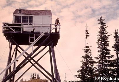
| FISHHOOK PEAK LOOKOUT | |
|---|---|
| R.I.P. 1931-1969 | |
Developed in 1922 with a 10' pole tower topped by a corrugated iron cupola, a log cabin was added 1/4 mile south in 1925. This 20' pole L-4 tower, built in 1931, was destroyed in 1969. There was also a patrol platform on Breezy Point 2 miles south. |
|
| St. Joe National Forest | |
| 10 miles southwest of Avery | |
| Shoshone County, Idaho | |
| Elevation 6531' | |
|
|
|---|