|
|---|
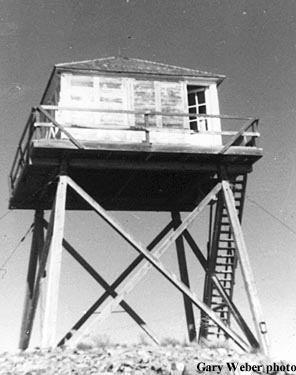
| IDAHO POINT LOOKOUT | |
|---|---|
| R.I.P. 1934-1971 | |
Located 1/4 mile from the Montana border and Eighty Peak Lookout, this 20' pole L-4 tower, built in 1934, was destroyed in 1971. |
|
| Coeur d' Alene National Forest | |
| 14 miles ENE of Magee R.S. | |
| Shoshone County, Idaho | |
| Elevation 6505' | |
|
|
|---|