
|
|---|
| COAL RIDGE LOOKOUT | |
|---|---|
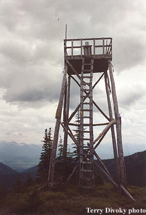
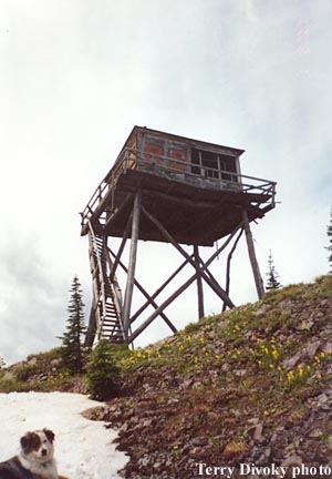
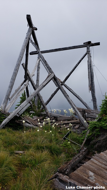
Coal Ridge actually consists of three lookout points along the ridgetop. The first was a cabin (still there, also called the Moran Patrol Cabin) at the northwest point (7285') in 1928. A 24' pole platform tower was added in the 1930's 1.5 miles southeast of the cabin at the 7100' level (ruins). Then in 1935 a 20' pole L-4 tower was constructed 1 mile southeast of the original cabin at the 7105' level. Used for emergencies in the 1960's, part of the ruins are still standing. |
|
| Flathead National Forest | |
| 8 miles southwest of Polebridge | |
| Flathead County, Montana | |
| Elevation 7105' | |
|
|
|---|