|
|---|
| STRYKER PEAK LOOKOUT | |
|---|---|
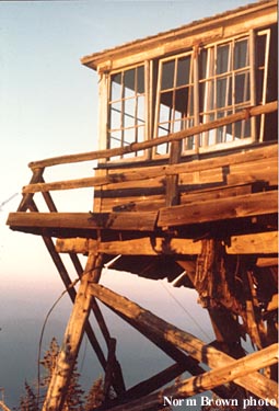
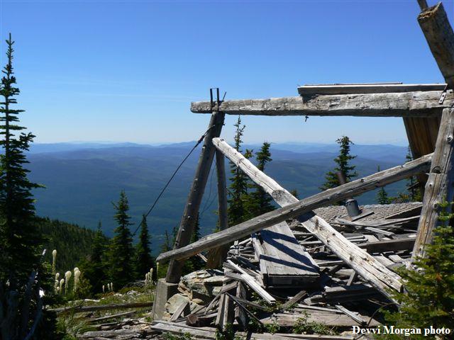
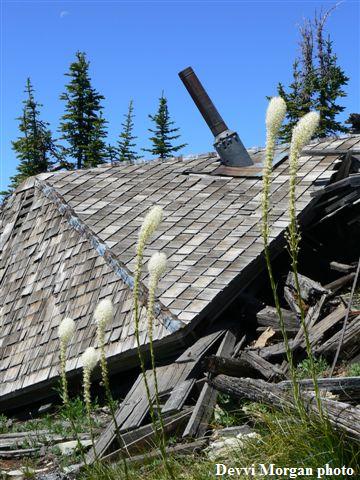
This 10' pole L-4 tower, built in 1935, was abandoned in 1955. It was still standing in this 1978 photo. In the 1960's, the Montana DNRC developed a lookout point 3 miles southeast of the summit using a converted school bus with cupola. |
|
| Kootenai National Forest | |
| 24 miles northwest of Whitefish | |
| Flathead/Lincoln County, Montana | |
| Elevation 7338' | |
|
|
|---|