|
|---|
| ANT HILL LOOKOUT | |
|---|---|
| R.I.P. 1935-1956 | |
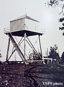
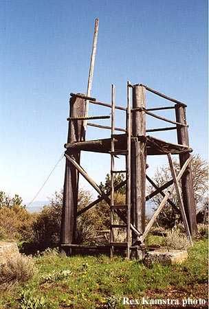
A 20' pole L-4 tower was built here in 1933, and destroyed in 1956. The history of the present 10' wooden platform tower is in question. If anybody knows, please let me know. Known lookout personnel: 1934: Harold Gentry; 1936: Harold Stevens. |
|
| Umatilla National Forest | |
| 7 miles northwest of Monument | |
| Grant County, Oregon | |
| Elevation 4602' | |
|
|
|---|