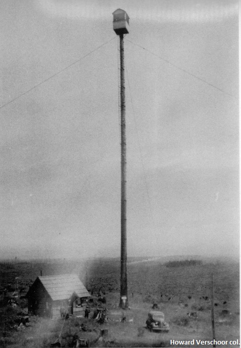
BAKER POINT LOOKOUT
1912: tree platform, camp. 1930s: 135' tree platform. 1941: 99' wooden L-6 tower. Destroyed in 1962 Columbus Day storm.
Columbia County FPA
5 miles northeast of Vernonia
Columbia County, Oregon
Elevation 1876'
Click for larger image
Photos courtesy the Howard Verschoor collection