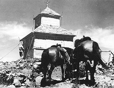
HORSE PASTURE LOOKOUT
R.I.P. 1922-1965
Developed as a camp in 1915, this D-6 cupola cabin, constructed in 1922, was destroyed in 1965.
Willamette National Forest
6 miles southeast of McKenzie Bridge
Lane County, Oregon
Elevation 5660'
Click for larger image
Photo courtesy the Fire Lookout Museum