|
|---|
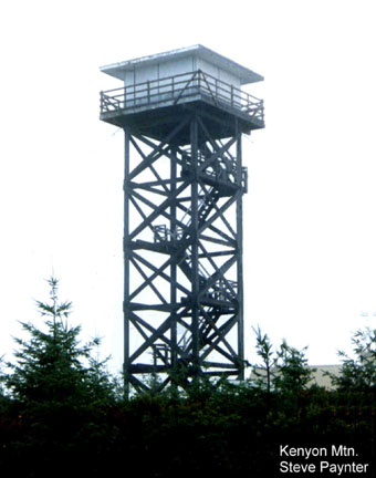
| KENYON (SIGNAL TREE) LOOKOUT | |
|---|---|
Preceeded by a 1920's cupola cabin and a 1935 100' wooden L-6 tower, this 53' treated timber tower with ODF cab, built in 1961, was replaced by a detection camera in the 2000's. The tower came down about 2011. It was listed on the National Historic Lookout Register. |
|
| Coos FPA | |
| 20 miles ESE of Myrtle Point | |
| Coos County, Oregon | |
| Elevation 3294' | |
|
|
|---|