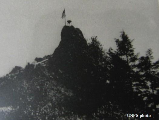
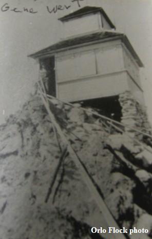
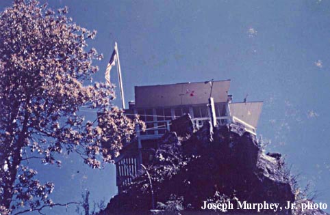
LARISON ROCK LOOKOUT
R.I.P. 1940-1970
Developed in 1918 with a cabin, a D-6 cupola cabin replaced it in 1927. An L-4 cab was built in 1940, destroyed in 1970.
Willamette National Forest
3 miles south of Oakridge
Lane County, Oregon
Elevation 3607'
Click for larger image
Photos courtesy of Mark Swift and Joseph Murphey, Jr.