|
|---|
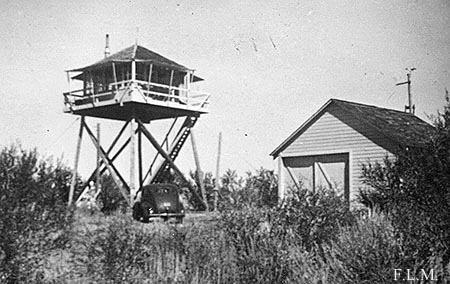
| LONG CREEK BUTTE LOOKOUT | |
|---|---|
| R.I.P. 1933-? | |
This 20' pole L-4 tower was built in 1933. The pole tower legs were replaced with treated timber legs later on. It's unclear when it was removed. |
|
| Malheur National Forest | |
| 19 miles NNW of John Day | |
| Grant County, Oregon | |
| Elevation 6206' | |
|
|
|---|