|
|---|
| TIPTOP MOUNTAIN LOOKOUT | |
|---|---|
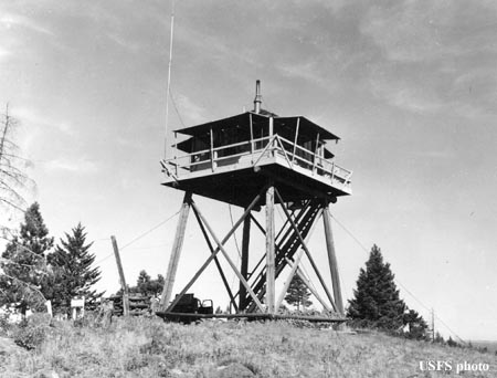
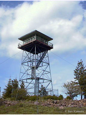
First used with a 1930's 15' pole L-4 tower, a 40' steel tower with live-in cab, built in 1959 & 1960, had been abandoned for a number of years and vandalized. The steel tower superstructure came from Johnson Ridge Lookout. A private party obtained and removed the tower in 2016, and relocated it to Long Ridge on private property in Wallowa County. Known lookout personnel: 1954: John Wright. |
|
| Oregon Dept. of Forestry | |
| 18 miles northwest of LaGrande | |
| Umatilla County, Oregon | |
| Elevation 4574' | |
|
|
|---|