|
|---|
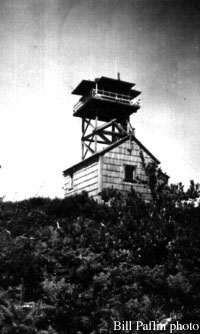
| INCLINE LOOKOUT | |
|---|---|
| R.I.P. 1938-1967 | |
Built in 1938, this 40' wooden L-4 tower, 2.5 miles southwest of the summit, was destroyed about 1967. |
|
| Washington State Division of Forestry/DNR | |
| 15 miles W of Castle Rock | |
| Waukiakum County, Washington | |
| Elevation 2291' | |
|
|
|---|